Consultancy
We offer a range of geospatial related services from the creation of mapping to full analysis of your data. We can deliver this remotely or onsite at your location.
We offer advice and services on 3D workflows and data pipelines. We are happy to create custom training/consultancy packages for knowledge transfer for your organisations.
We are pioneers in the use of ArcGIS Pro and ArcGIS CityEngine for urban design and city master planning projects.
We have also worked on innovative workflows for using 3D scans from the iPhone Pro LiDAR sensor.
GD3D created and sponsored the British Cartographic Society’s 3D Mapping Award running since 2018!

Knowledge Transfer
We were the first to offer Esri/ArcGIS CityEngine training worldwide, and we’ve been doing project work with it since 2009. We have been conducting formal CityEngine training courses since 2013 for a wide range of clients.
We are now the first Esri partner to offer CityEngine training online direct from us and via Planetizen.
Content Creation
We can do the hard work so you don’t have to!
From procedural rule files to 3D models for use in professional modelling tools. We can create CityEngine rule libraries for specific datasets and help you source 3D geospatial data through our partners.


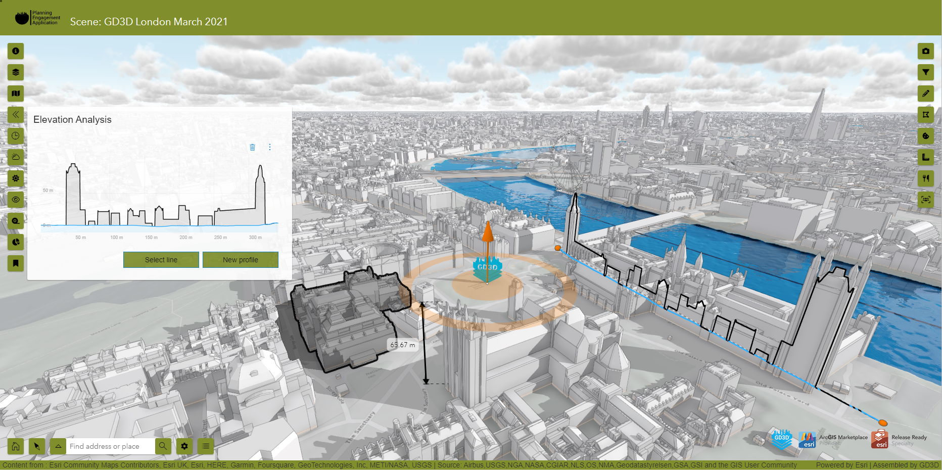
Planning Engagement Application
Our custom 3D web application for planning and urban professionals is now in its 5th version. A simple to setup and use application built on ArcGIS Maps SDK for Javascript technology. This really is a great way to engage with stakeholders and utilise your own data stored in ArcGIS Online.
Unreal Geospatial
Stuck in boring old GIS? Do your clients want to play games, or do you need a high quality visualisation of urban planning scenarios within a geospatial context? We have you covered our team have the capabilities to help create high quality engagement applications built on the Unreal Engine platform.


City Information Models
We have been helping the City of Lancaster in partnership with ImaginationLancaster implement a “City Information Model” (CIM), the first step in the road towards a city and district wide “Digital Twin“. Our first 3D opendata set has been released as part of this project.
We have learnt a lot and can now do the same for your city or area. Contact us for a discussion or click on the buttons to read more.
3DPathFinder on YouTube
Updated regularly with short form video content on ArcGIS CityEngine and 3D related workflows as well as occasional demos and ‘chats’ with industry experts. Like and subscribe to keep yourself updated!


3D Mapping Award
The annual British Cartographic Society 3D Mapping Award now in its 8th year was created and sponsored by GD3D® in 2018 . It is an exciting competition open to everyone in any industry creating interesting, informative, exciting 3D cartography (real or imagined) using any technique and/or medium!